Stories posted under Pinkbike Community blogs are not edited, vetted, or approved by the Pinkbike editorial team. These are stories from Pinkbike users.
If a blog post is offensive or violates the Terms of Services, please report the blog to Community moderators.
Barker Dome
Trip to Barker Dome, NM.Winter reprieve.
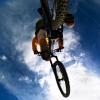
Unsecure image, only https images allowed: http://jerryhazard.com/barker2011a/content/images/large/GOPR1926.jpg
We in the four corners area have been blessed with (at least) a hint of early spring. Temps in the 50's and 60's last week really put the melt on. I've been doing bi-weekly dips in to New Mexico to roll my wheels on the dirt for a while now, but the last week has been a real treat. Friday I was looking for a change of pace, as Road Apple can get old quite quick if it's the only place one is pedaling. Enter Barker Dome.
What is Barker Dome?
Barker Dome is located near the town of Marvel, CO., about an hour and half south and west from Durango. I don't think you'll find it on any Lat 40 maps, or on the trail reviews at mtbr, you wont' find much info about it online either. Here's an entry I found:
Barker Dome is a mountain summit in San Juan County in the state of New Mexico (NM). Barker Dome climbs to 7,133 feet (2,174.14 meters) above sea level. Barker Dome is located at latitude - longitude coordinates (also called lat - long coordinates or GPS coordinates) of N 36.991666 and W -108.303415.
The beauty of Barker Dome is probably also responsible for its lack of popularity; its remote, non really maintained, not well marked, and not easy to ride. So, definitely not for everyone.
Red box indicates trails...
Unsecure image, only https images allowed: http://jerryhazard.com/barker2011a/barkerdome3a.jpg
You will likely spend as much time walking as you will riding your first time or two. There is a lot of climbing up bumpy, undulating slickrock, some interesting techy spots, a few short sections of keen dirt singletrack (mostly going downwards) and some sandy spots.
Unsecure image, only https images allowed: http://jerryhazard.com/barker2011a/content/images/large/domestill2.jpg
The entrance is level dirt singletrack, then it descends through a few trees, and over a couple rocky "moves". Nothing white knuckled here, but you do have to pay attention. Shortly thereafter, you exit the the trees into a slickrock-ish canyon. There is no obvious route to follow, but you can guess pretty easy and begin climbing/picking your way up the little canyon. Narrow at first, it opens up after a few hundred yards.
Unsecure image, only https images allowed: http://jerryhazard.com/barker2011a/content/images/large/domestill1.jpg
Unsecure image, only https images allowed: http://jerryhazard.com/barker2011a/content/images/large/domestill3.jpg
The beginning of climbing up the canyon...
Unsecure image, only https images allowed: http://jerryhazard.com/barker2011a/barker_start.jpg
The photo above will give an idea of the kind of rock you will encounter - bear in mind that most of it be more open, not enclosed in the canyon pictured. It its very ledgy - again, there is not an "obvious" path to follow, though if you look, you will find the odd cairn here and there, plus tire marks in the dirt between the rocky sections. Lots of technical moves and plenty to play on.
After you get out of the canyon, the rocky area opens up, and finding the way becomes a bigger guessing game. The surface is slickrock gritty and grabby, no worries for traction. You will be climbing for a while. As you summit the climb, you'll notice a gas line/metal pole that traverses the "peak" - you don't need to go past this, but continue to your right. The way here will be fairly obvious, and you'll pick up a singletrack that heads off in to the scrub oak. On the map, this where the trail turns back towards the way you came. You'll follow this trail down in to another canyon, but the tail is mostly dirt, all downhill, and is not boring. Wish it lasted a bit longer though. Once at the bottom, the guessing game begins again as you'll repeat the route finding back up another slickrock section. And again, once at the top, you come back down another dirt singletrack though the scrub oak. This one is a bit more techy than the first, with a little exposure and a couple little rocky moves to test how well you can pick your way through a few steep rocks. When you get the bottom of this trail, you'll be following a drainage back towards the road, you switch sides of the drainage a couple times, and ultimately the you come to a "T". This trail will have evidence of motos and may be sandy. To the right will take you out to the road and back towards your vehicle. To the left (I presume) leads to the upper loops. I have not traveled those yet. Next visit...
Unsecure image, only https images allowed: http://jerryhazard.com/barker2011a/content/images/large/barkerdomeedit.jpg
The map above gives a pretty accurate layout of the trail/paths, and its a good idea to have this with you as you ride, or at least remember the general layout of the trail - it definitely was an positive aide in finding my way about. I spent a couple hours there and just did the lower loops on the map. Next time, I'll be faster through there and will explore the upper section - I've read there is a sort of slickrock halfpipe in that section, so I'm excited to get back up there!
Unsecure image, only https images allowed: http://jerryhazard.com/barker2011a/content/images/large/GOPR1929.jpg
This is the gate near the trailhead. Don't need to drive past here. There's a left turn
just before this gate, and that leads to the trailhead. La Plata Mountains and
Durango lurk in the background here.
Barker Dome is a great way to spend an afternoon with your bike. Notice I said "with your bike" and not "on your bike". You will hike-a-bike. You will find challenging terrain, and you will fee like you've gotten away from it all. Save for maybe a few motos in the background here and there. Barker Dome is on BLM land, so the multi use rule applies. You'll see some motos, maybe an atv, but most likely you'll be in solitude, save for an oil truck checking some of the drill stations in the area.
Go-Pro footage - Various clips from the excursion (nothing super exciting, just to give a feel for the area)
Thanks for looking!!
Author Info:
 Member since Feb 9, 2009
Must Read This Week
[UPDATED] Final Elite XC Results & Overall Standings from the Mairiporã XC World Cup 2024
42394 views
42394 views
Sign Up for the Pinkbike Newsletter - All the Biggest, Most Interesting Stories in your Inbox
PB Newsletter Signup
4 Comments
- 1 0
Enjoy all your vids, and now articles too!
- 1 0
- 1 0
Nice one!
- 1 0
Thanks, and thanks again for your help!
Login or Sign Up